Rangraz exploration area with exploitation license is located in Markazi province, 17 km northeast of Saveh city and near Kaveh industrial town.This area with an area of 6/4 square kilometers is part of the Urmia-Dokhtar volcanic-intrusive belt.
Ore deposit type
Genesis: Copper veins associated with intrusive mass
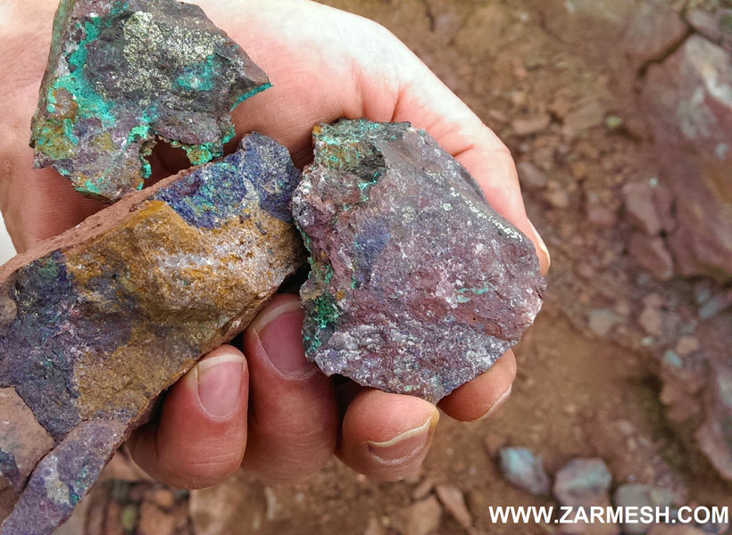
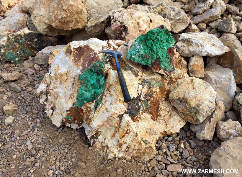
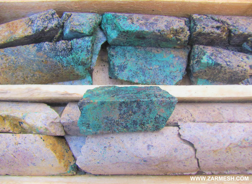
Paragenesis of minerals: Malachite, chalcocite, chalcopyrite, azurite, cuprite, oligist and barite
Gangue type: Silica mineral, limonite, calcite
Geochemical paragenesis: (Cu, Au, Mo), (Fe, Mn)
Geology
Structural Zone: Central Iran, Urmia-Dokhtar volcanic-intrusive belt
Host rocks type: Andesite, basaltic andesite, trachyte, quartz monzodiorite and pyroclastic units
Age of the host rock: Eocene to Miocene
Alteration: Argillic, Silicification, Carbonatization, sericitization and propylitic alteration
Dimensions of mineralization
In general, due to the mineralization of the area, the entire rangraz mineral area is divided into 7 exploration target areas.
And includes the target area (A1) with a length spread of 400 meters and a width spread of 200 meters and has copper vein mineralization, Target area (A2) with 420 m length spread and 210 m width spread with copper vein mineralization, Exploration target area (B1) with length spread of 850 meters and width spread of 300 meters with copper vein mineralization, Exploration target area (B2) with length spread of 400 m and width spread of 150 m with copper vein mineralization, Exploration target area (C1) with length spread of 500 m and width spread of 200 m containing mineralization of iron, manganese, copper and barium, Exploration target area (C2) with length spread of 150 meters and width spread of 50 meters, containing iron, manganese and vein copper And the exploratory target area (D) with a length spread of 800 m and a width of 400 m, with gold and copper anomalies.
Proven reserve
Total definite reserve, considering 0.2% as the economic limit, Equivalent to 1206402 tonnes of oxide copper ore with an average grade of 0.7%.
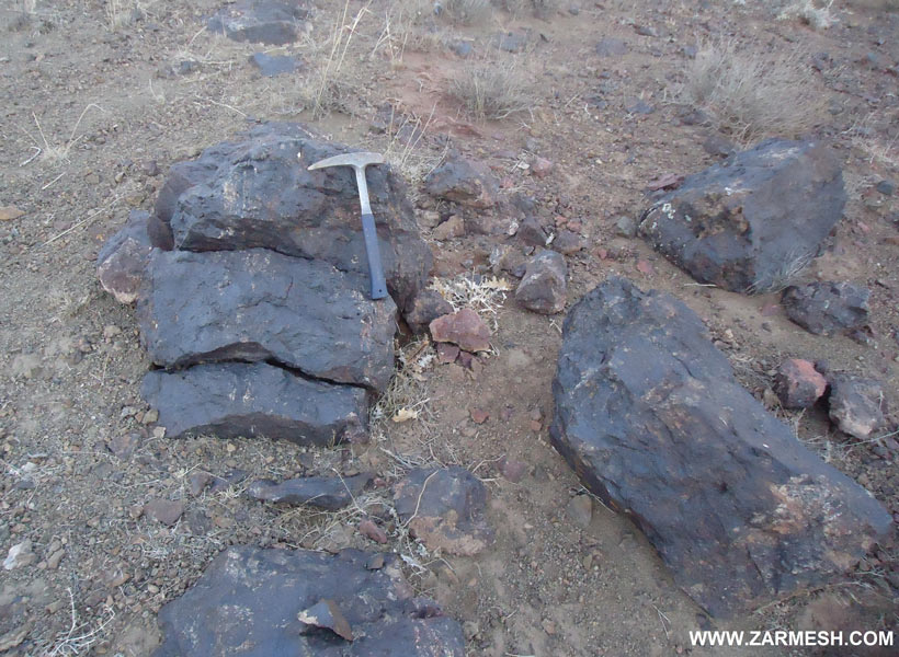
Also, the total definite reserve of hematite iron is equal to 65000 tonnes with an average Fet grade of 31%.
Mineral grade
Cu maximum 7/1% and average 1/1%, Au maximum 1662 ppb, Fet maximum 53% and average 30%, MnO2 maximum 65/5% and Mo maximum 530 ppm Facilities.
The short distance of the area from Kaveh industrial town and Mamuniyeh city can be useful in providing manpower and equipment.
Exploration operations
- Collecting of available information; Including geological and topographic maps, previous reports, etc., office work and planning for field operations
- Buy high resolution satellite images as aerial photographs of the study area
- Field operations including surveying and tracing of the area and determining rock units and important geological features as well as separation of veins and mineralization zones
- Preparation of a geological map at a scale of 1: 20,000 in an area of 645 hectares
- Preparation of geological and topographic map of the area at a scale of 1: 5000 with an area of 8.8 square kilometers
- Sampling of streaks, mineralized zones and halos of alteration in the prospecting stage for 62 samples for analysis by ICP-OES and Fire Assay
- Sending 62 samples for chemical analysis by ICP-OES and Fire Assay methods in different sampling stages
- Preparation of 9 thin and polished sections for petrographic and mineralogical studies
- Preparation of topographic map with a scale of 1: 1000 with an area of 70 and 342 hectares
- Preparation of geological map at a scale of 1: 1000 with an area of 103/3 hectares
- IP-RS geophysical operation in two stages for 905 and 703 points in mineralization and alteration sections
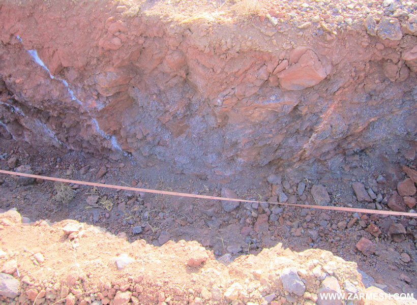
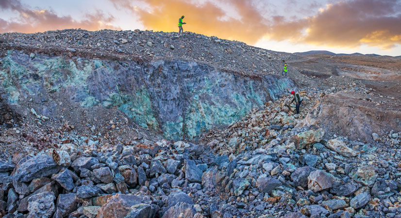
- Excavation of 113 exploratory trench
- sampling and analysis ICP-OES of trenches in 153 samples
- sampling and analysis XRF of trenches in 33 samples
- Preparation of trenches cross section with an area of 724/5 meters
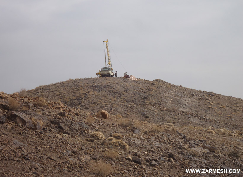
- Drilling 12 exploratory boreholes with a total length of 650/5 meters
- Logging and studying RQD and RC core drilling and cutting boreholes with a length of 650/5 m
- Sampling, sending, preparing and analyzing 136 samples taken from core boreholes for Fire Assay and ICP-OES analysis
- Preparation of 8 thin and polished sections for logging studies
- Drilling 44 powder exploration boreholes with a total length of 474 meters
- Sampling, Sending, Preparing and Analyzing 237 Samples Taken from Powder Boreholes for Copper Analysis Using Atomic Absorption Spectroscopy (AAS)
- Evaluate and determine the volume, shape and tonnage of mineralization area reserve based on trenches and boreholes drilled using advanced software
- Preparation of the final exploration report during the extraction along with the maps and all relevant appendices.