Kanif 2 exploration area is located in the west of Kanif village on Sarbisheh-Doroh road and covers an area of 4.34 square kilometers. This area is part of the Loot block area.
Kanif 2 Exploration Area
Projects
Ore deposit type
Genesis: Possible Massive sulfides Copper
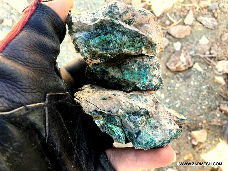
Paragenesis of mineral: Chalcopyrite, Chalcocite, Malachite
Gange type: Silica, Calcite, Hematite, Limonite, Goethite, Siderite, Pyrite, Serpantine, Talc
Geochemical paragenesis: Cu
Geology
Host rock type: Ophiolites, Plagiogranite, Ultrabasics, Listivinite, Diabase, Gabbro
Age of the host rock: Cretaceous
Alteration: Argillic, Serpentination, Talcization, Iron oxide and hydroxsides,Silicification
Reserve Amount
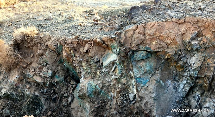
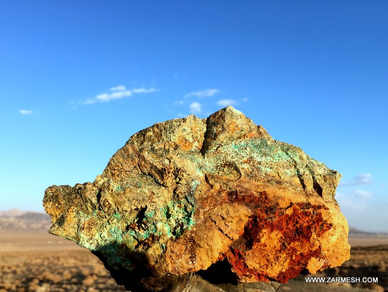
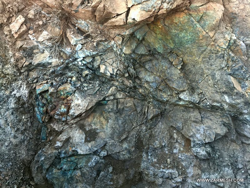
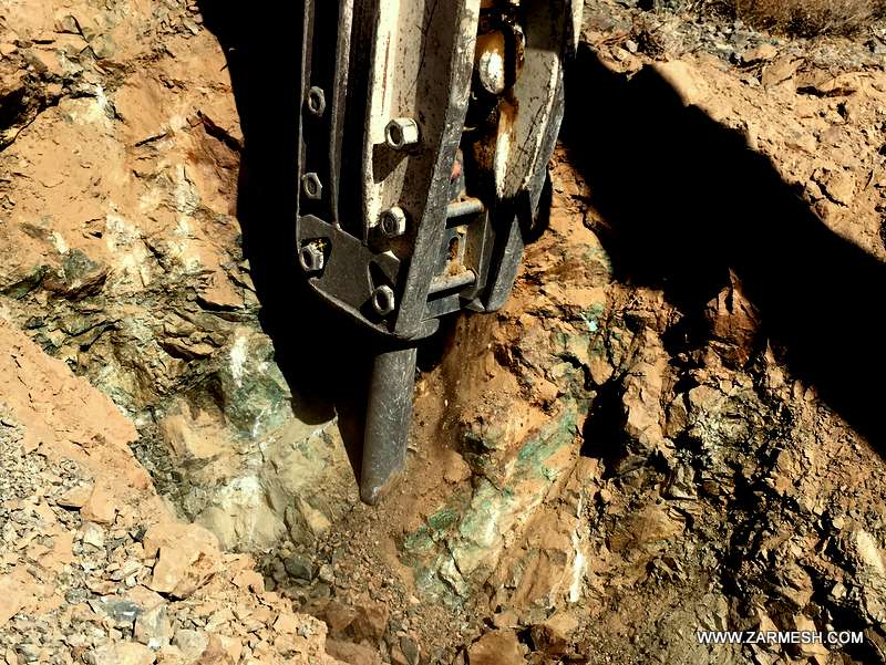
Copper mineralization was identified as minerals such as Chalcopyrite, Chalcocite and Malachite in the longitudinal expansion of at least 2000 meters and the transverse expansion of at least 30 meters in the range.
Considering that exploration operations are underway in the area and geophysical operations in the area are currently completed and the exploration team is planning for the surface drilling phase, the exact amount of reserves has not been estimated yet, but given the evidence and good geological potential in the area as well as the minerals identified in the area, a reserves of several hundred thousand tons can be predicted for Copper ores.
Proven Reserve
Designing and drilling exploratory trenches are ongoing and the proven reserve is not estimated yet.
Mineral grade
Cu average 0.7% and maximum 3.2%
Facilities
The village of Kanif, which is located within the area and has water and electricity, as well as the town of Doroh, which is located 22 km southeast of the area, has all the facilities.
Exploration operations
- Collecting information; including geological and topographic maps, previous reports and…, doing office work and planning for field operations.
- Processing of SENTINEL-2 and ASTER satellite data for extraction of alteration minerals related to mineralization, analysis of geological structures and features, and separation of rock units.
- surveying, processing and integrating the data base information, creating databases and identifying areas that is suitable for exploration
- Field operations including surveying and surveying the area and identifying rock units and important geological features as well as separation of veins and mineralization zones.
- Sampling of veins, ore zones, alleles of alteration and remnants of ancient mining in the search phase to 14 samples.
- Preparation, sending of samples, and chemical analysis of gold and associated elements by ICP OES, Fire Assay and XRD to 14 samples.
- Geophysical operations by IP and RS for n points in 12 profiles
- Preparation of a geological map in the scale of 1:20,000 in an area of 3.9 square kilometers.
Ownership
This area is about to receive an exploration license and belongs to Zar Azin Gostar Consulting Engineer Company.


پروژه های زرمش

Silijerd Exploration Area
Silijerd exploration area with exploration license with an area of 23.3 square kilometers is located in Markazi province, 17 kilometers northwest of Saveh city in Iran. This area is part of the Urmia- Dokhtar

Khalkhab Exploration Area
Khalkhab exploration area with exploitation license is located in Markazi province, north of Saveh city and northeast of Chenar village.This area with an area of 14.3 square kilometers is part of the Urmia-Dokh