Kurd khalaj area has a industrial Minerals license and an exploration license for polymetal mineral as the second mineral. This area with an area of about 6 square kilometers is located in Markazi province, 30 kilometers northwest of Saveh city in Iran.
Ore deposit type
Genesis: Cu-Fe- Skarn, Epithermal Gold and Copper,intrusive units which bearing Copper.
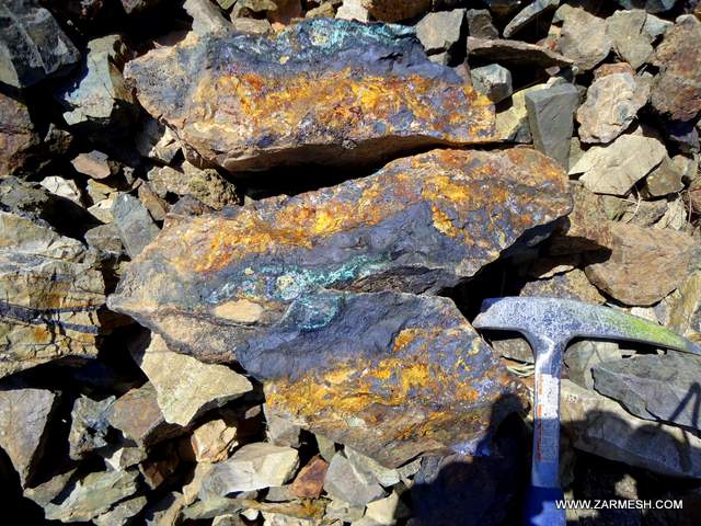
Paragenesis of mineral: Chalcopyrite, Chalcocite, Pyrite, Malachite, Azurite, Magnetite, Hematite and Specularite
Gange type: Silica, Calcite, Actinolite and Tourmaline
Geochemical paragenesis: (Au, As, Ag), (Cu, Fe), (Mo)
Geology
Structural zone: Central Iran zone, Urmia-Dokhtar volcanic belt
Host rock type: Andesite, Andesitic tuff, Rhyodacitic tuff, Lithic tuff, Latite, Dacite and intrusive units of Diorite, Quartz diorite and Gabbro
Age of the host rock: Eocene to Miocene
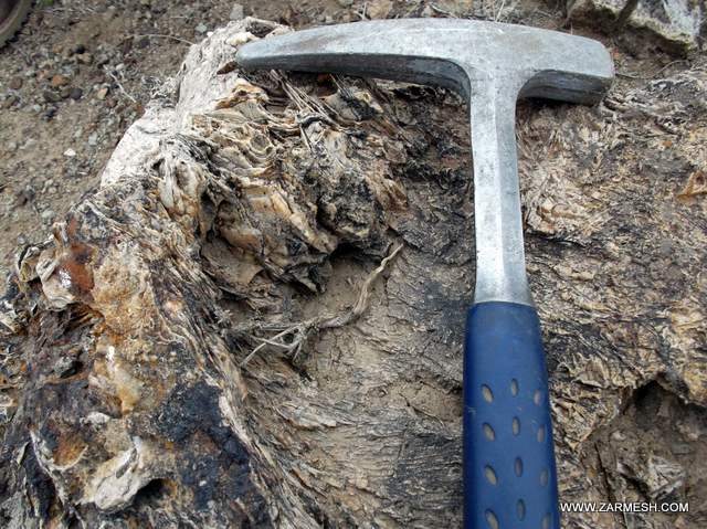
Alteration: Silicification, Sericitic, Argillic, Propylitic, Hornfels metamorphic, Hematite Alteration
Dimensions of Mineralization
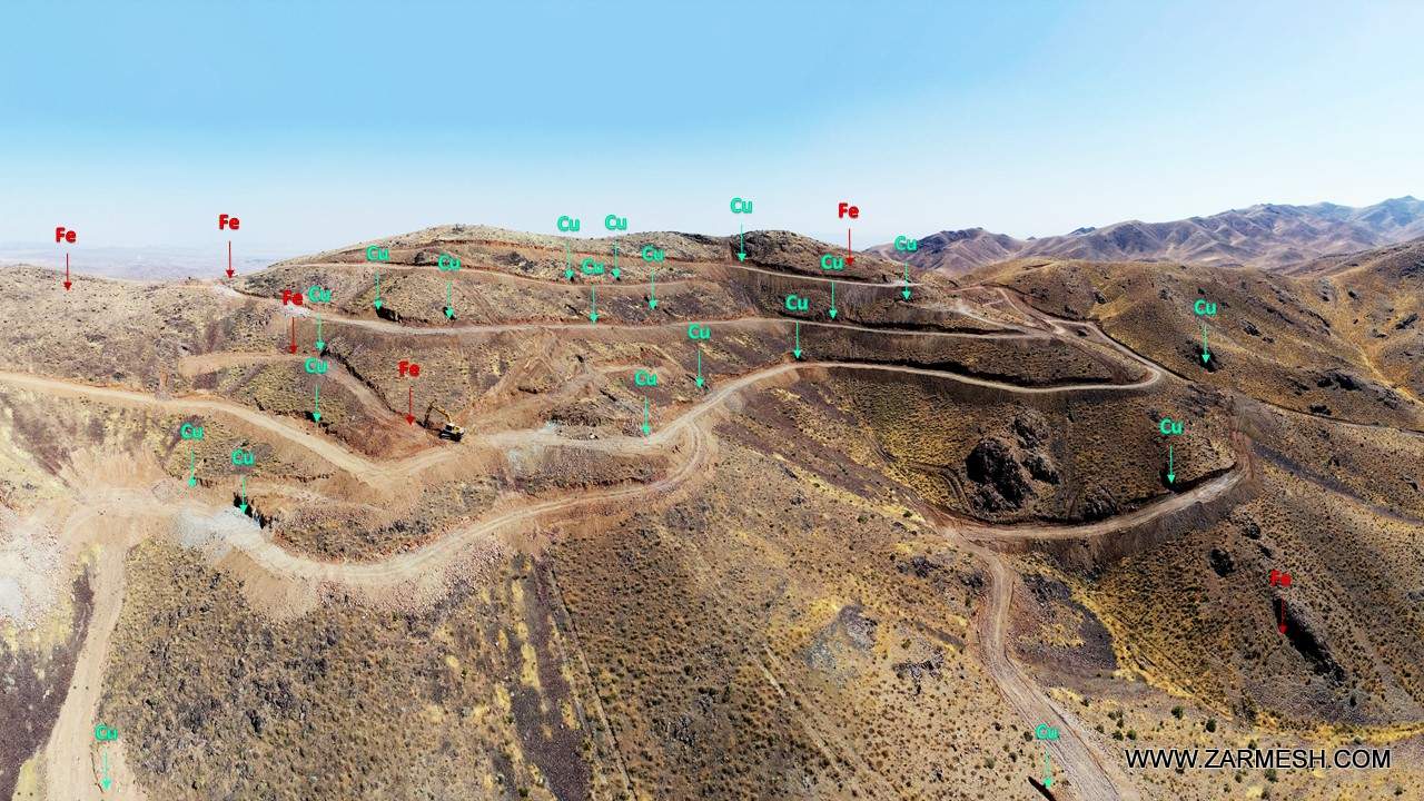
The area has a copper-iron mineralization zone with a length of 1000 meters and a width of about 500 meters and two zones containing copper mineralization with an area of 107 hectares are scattered.
Gold and copper mineralization is seen in the east of the area in the form of siliceous-calcite veins with a length of approximately 1 km and a thickness of 1.5 meters.
Proven reserve
The total reserve in the Kurd khalaj area, considering 0.3% as the economic limit of copper, is equal to 324667 tons of copper ore with an average grade of 0.64%, and considering 20% as the economic limit of iron, it is equal to 332952 tons. with average ore grade is 24/6%
Mineral grade
Copper average 0/64% and maximum 5%
Fe average 24/6% and maximum 44%
Gold averages 169 mg / ton and a maximum of 2364 mg / ton
It should be noted that Mo and Pb elements also have anomalies in the desired area.
Facilities
There is water and electricity at a distance of 5 km from this area. There are also several dirt roads to access the area.
Exploration operations
- Collecting information; including geological and topographic maps, previous reports and…, doing office work and planning for geological field.
- prospecting and identifying mineralization
- Examine, process and integrate basic information layers, create a database and identify suitable areas for exploration by Remote sensing
- Preparation a geological map at a scale of 1: 20,000 in an area of about 6 square kilometers
- Preparation of faults, alteration and veins maps with the scale of 1:20,000
- Collecting 56 sample from mineralization, veins and contact rock units
- Collecting 56 samples for chemical analysis by ICP-OES and Fire Assay method.
- Collecting 7 samples for XRF
- Collection of 11 rock samples to prepare microscopic thin sections for petrographic studies in all phase
- Geophysical operations by IP and RS for 893 points in 12 profiles
- Geophysical operations by magnetometric method in 1085 stations with an area of 50 hectares
- Preparation a topographic map at a scale of 1: 1000 and taking an orthomosaic image with an area of 180 hectares by photogrammetric method with UAV
- Preparation of a geological map with a scale of 1: 1000 in 4 parts of the area with a total area of 179 hectares
- Construction and repair of 14 km access roads
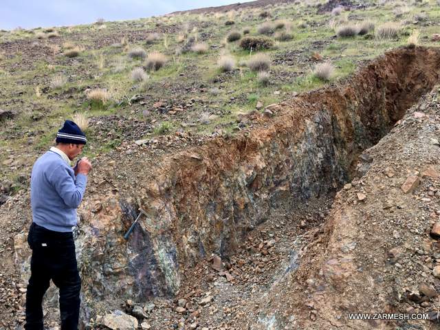
- Drilling of 59 trenches in the northwestern part of the area with a length of 546 meters and a volume of 1280 cubic meters
- Excavation and drawing sections of exploratory trenches
- Preparation of trench samples and chemical analysis to measure the amount of elements by ICP-OES method for 29 samples and XRF for 59 samples
- Drilling 11 Boreholes to a depth of 1738 meters
- Logging of drilled cores with a length of 1331 meters
- Sampling of drilling cores with 294 samples and analysis by ICP-OES method with 101 samples, XRF with 181 samples, 3 samples for Fire Assay analysis and 9 samples for analysis of rare earth elements (REE)
- Evaluation and determination of volume, form and tonnage of mineralization area based on trenches and drilling cores using advanced software.
- Preparation of final report