
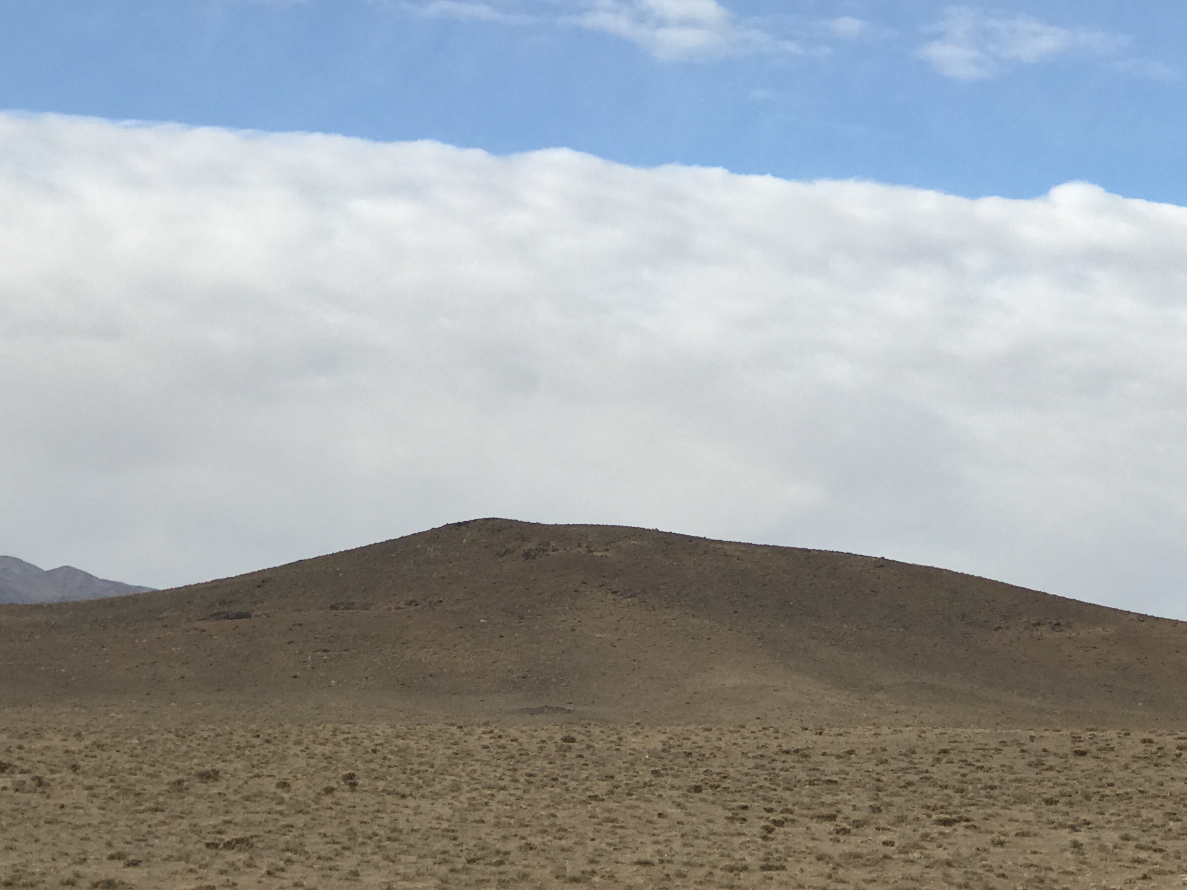
Polymetallic Area of Hajib is located in Qazvin province, Bouyin Zahra city. This area is located in the exploratory zone of Central Iran (Orumiyeh Dokhtar ). Access road to the to the district is possible through 48 km of Bouin Zahra-Saveh highway and from Hajib village. After entering this village and passing about 1.5 km from the dirt road, it is possible to enter this district from the southwest.
Polymetallic Area of Hajib
Projects
Reserve Type
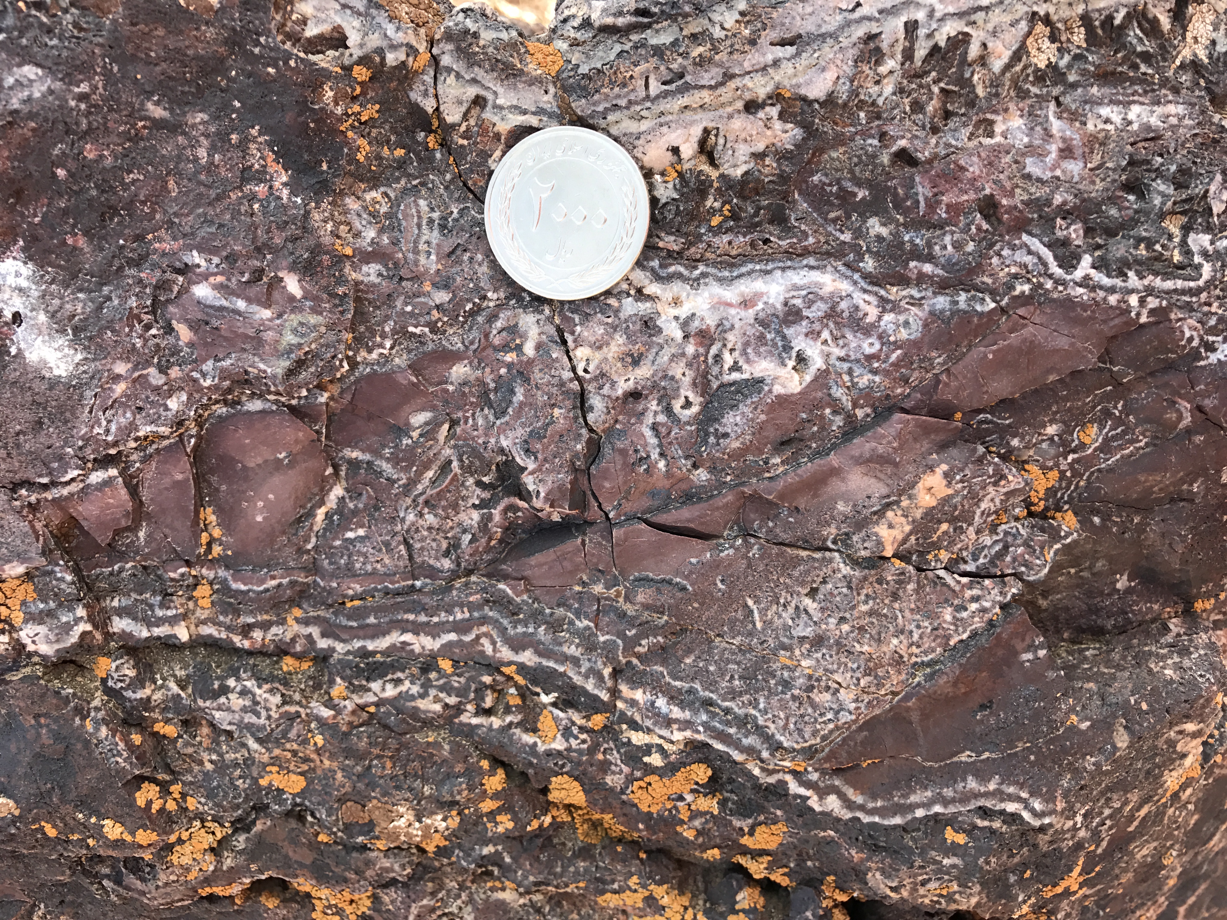
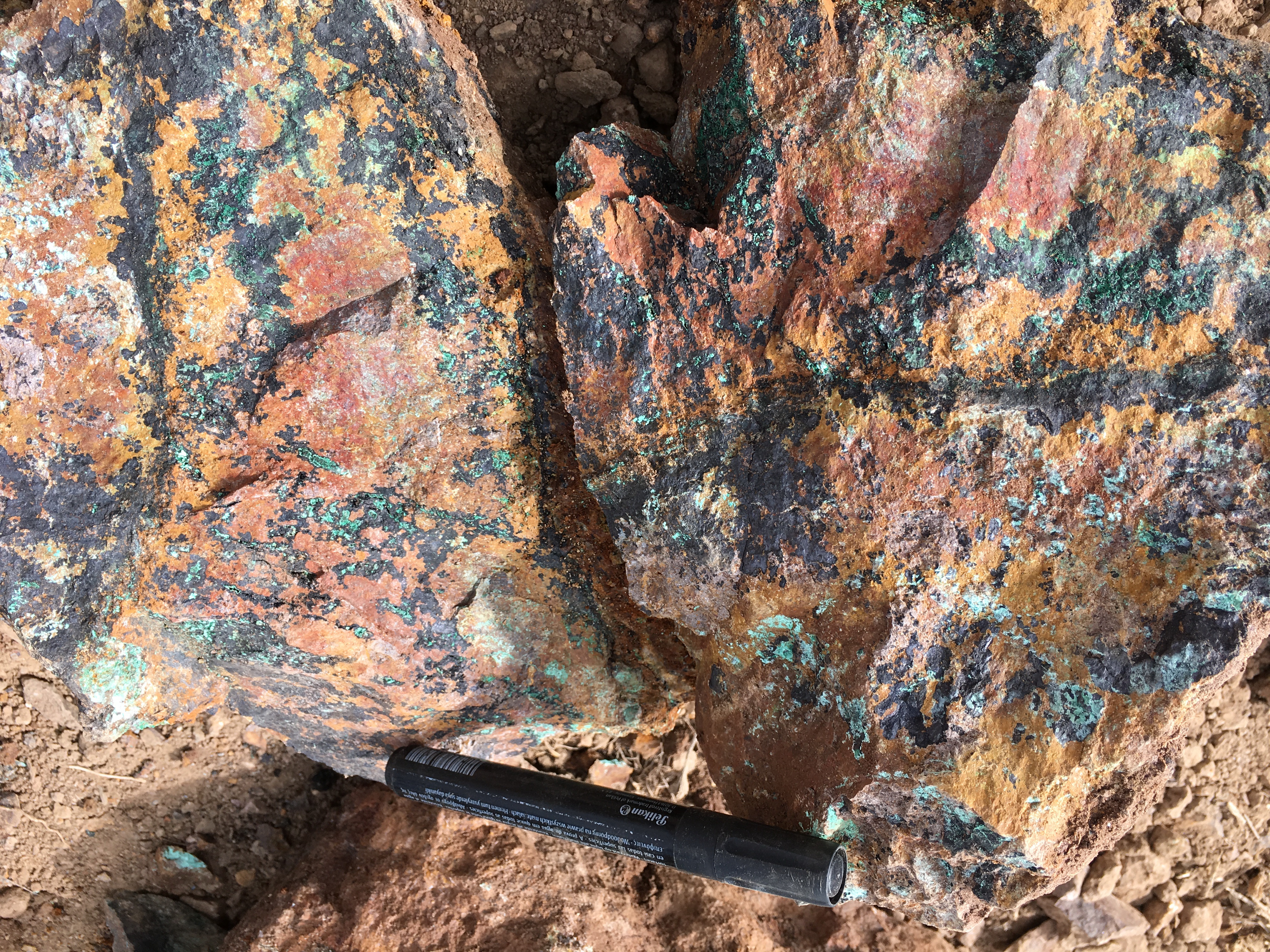
- Genesis: Polymetallic veins of Gold, Copper, Lead, Zinc and Silver veins related to porphyry systems.
- Paragenesis: Chalcopyrite, Malachite, Azurite, Chalcocite, Sphalerite, Galena, Cerussite and Smithsonite.
- Gange type: Silica, Barite, Hematite, Goethite and Limonite.
- Geochemical Paragenesis: Au, Cu, Pb, Zn, Ag, Mo, Sb, AS
Geology
- Host rock: Meta–Andesite, Andesite, Lithic tuff and Ignimbrite tuff
- Age of host rock: Eocene
- Alteration Silicification, Sericitic, Argillic, Goethite and Hematite.
Reserve Amount
At present, we are operating exploration including drilling borehole and exploration work face. However, data from surface prospecting and existing trenches show that about a few million tons of geological reserve of sulfide and oxide ore of gold and copper allong with other minerals can be proven.
Facilities
The village of Hajib which has water and electricity is located 1.5 km away and can be accessed to Hajib area from the village by dirt road.
Exploration operations
- Collecting existing information; including geological and topographic map, previous reports, etc., doing office works and planning for field operations.
- Processing of Sentinel-2 and ASTER satellite data to extract alteration minerals related to mineralization, analysis of structures and geological complications and separation of rock units.
- Study, process and integration the basic layers of information, create databases and identify suitable areas for exploration.
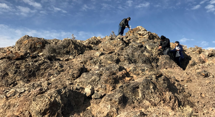
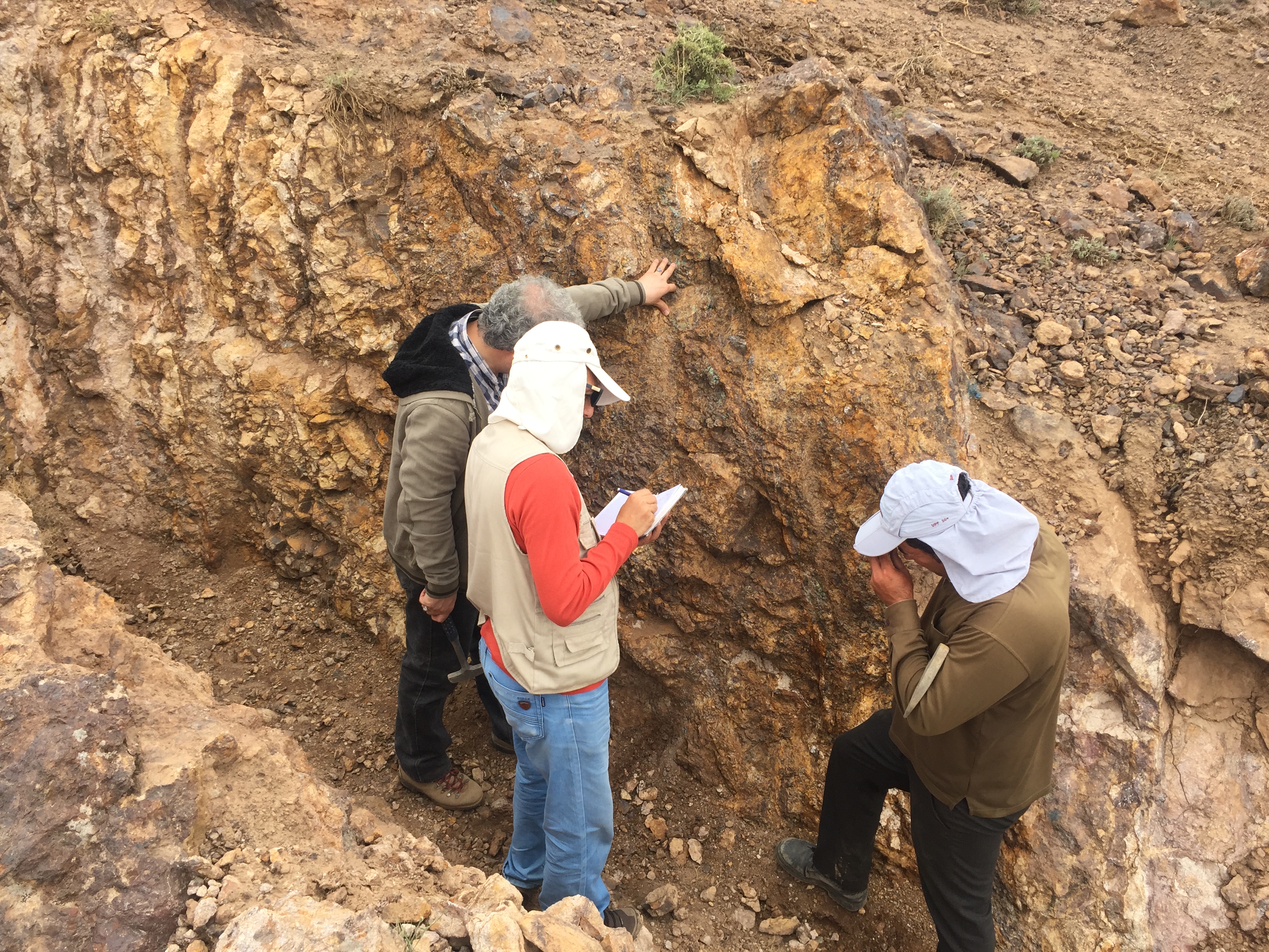
- Field operations including tracking and prospecting of the area and identifying rock units and major geological complications as well as separation of veins and mineralization zones.
- Taking 27 samples from veins, mineralized zones, alteration halos and old mining remains in prospecting phase.
- Preparation, sending samples and chemical analysis of 27 samples of gold and other elements by the ICP-OES and Fire Assay methods.
- Design of lithogeochemical sampling network and taking 88 samples as channel sampling and
- Preparation, sending samples and chemical analysis of 88 samples of gold and other elements by the ICP-OES and Fire Assay methods.
- Processing the lithogeochemical data and praparing grade variation map.
- Preparation the geological map in the scale of 1:20,000 in the area of 7.88 km2.
- Preparation faults and veins maps in the scale of 1:20,000.
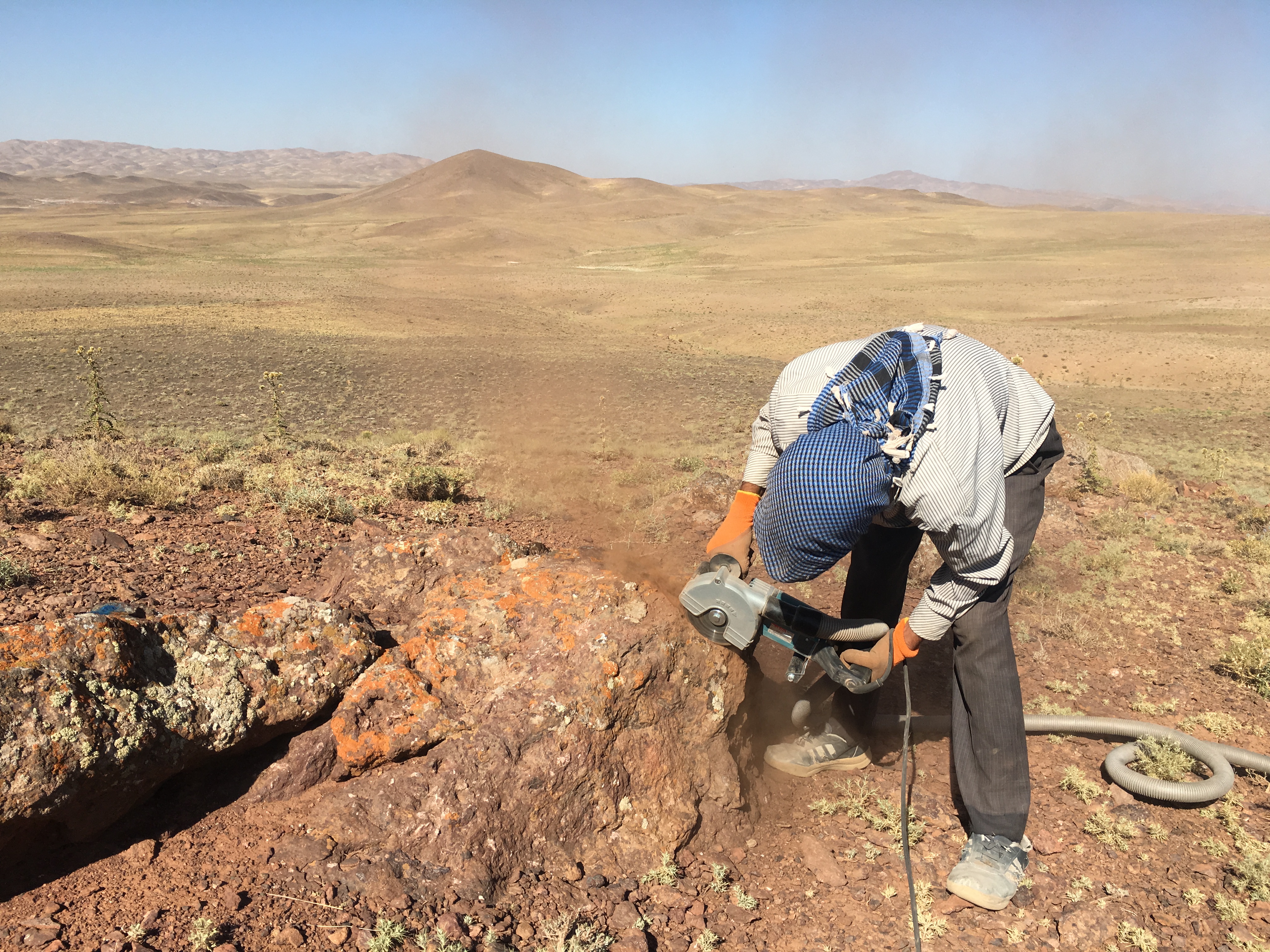
- Taking 4 rock samples and perform thin section studies.
- IP & RS geophysical operations in 16 profiles and 1522 stations.
- Construction the access roads and restoration of old roads totally 7 km.
- Digging 74 exploration trenches of 1936 m3 and length of 1076 m.
- Taking 130 samples from trenches and survey of trenches.
- Analysis the samples from trenches using the ICP-MMS and Fire Assay methods and check the variation of the elements grade.
- Preparation the trenches sections in the length of 1076 m.
- Preparation of topography map with the scale of 1:500 using aerial imaging using drone (198 hectares).
- Digging exploration work face
- Perform pre-processing studies on the ore samples.
- Drilling 9 exploration boreholes with a total length of 500 meters so far
Provide a report on the stage of tracking, prospecting and general exploration with maps and all relevant annexes.
Ownership
This area has Exploration License and it is belong Seyed Ahmad Meshkani and Mehdi Rasouli Noori.


پروژه های زرمش

Silijerd Exploration Area
Silijerd exploration area with exploration license with an area of 23.3 square kilometers is located in Markazi province, 17 kilometers northwest of Saveh city in Iran. This area is part of the Urmia- Dokhtar

Khalkhab Exploration Area
Khalkhab exploration area with exploitation license is located in Markazi province, north of Saveh city and northeast of Chenar village.This area with an area of 14.3 square kilometers is part of the Urmia-Dokh