
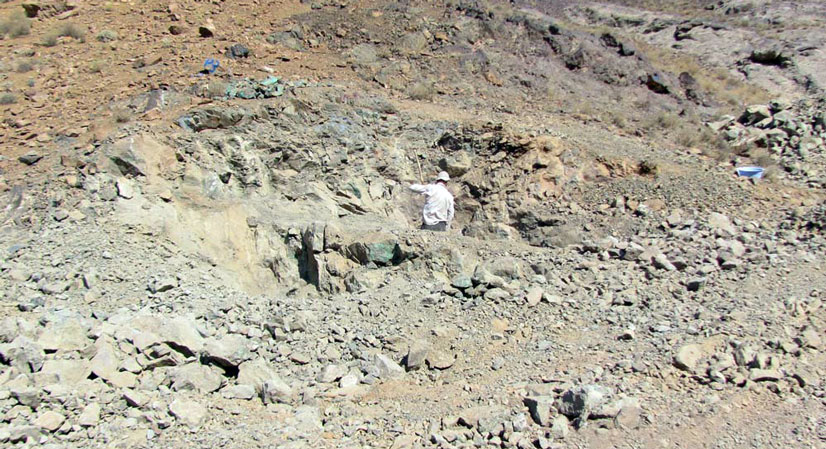
Copper district of Kahak with the area of 18.4 square kilometers is located in the province of Qom near the city of Kahak. This area is located in the Urmia-Dokhtar exploration zone, the target district is in 20 km from the asphalted road (Qom to Kashan road) from Qom to Kahak and in a dirt road in 5km of the east of the district.
Kahak Cu
Projects
Reserve Type
- Genesis: Michigan vein (Manto Type), Basaltic Copper (Copper in the vicinity of Carbonate Iron ore – volcanic unit)
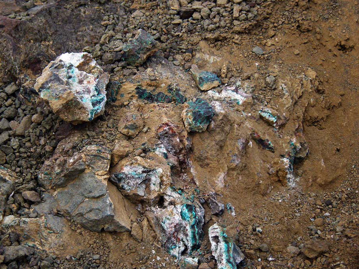
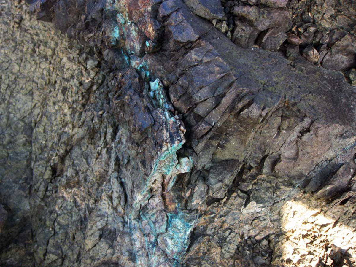
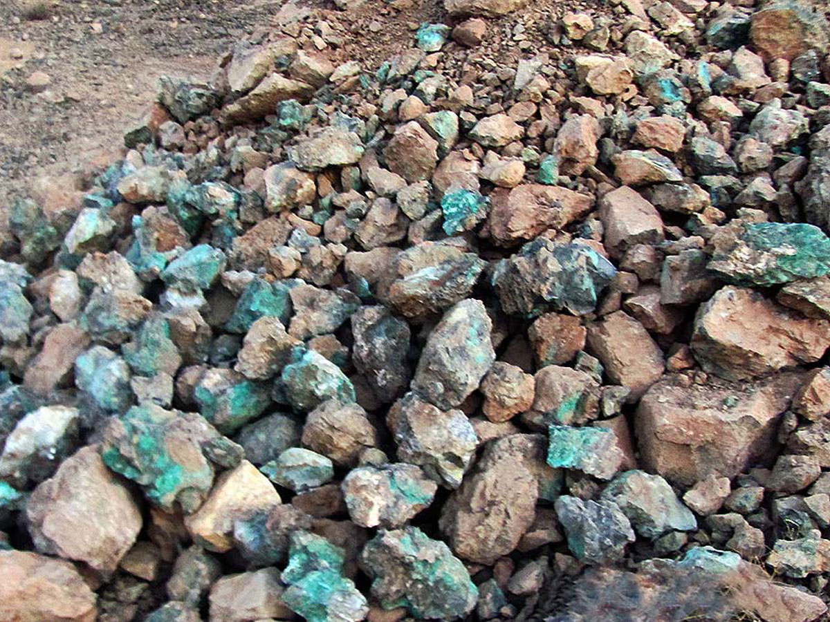
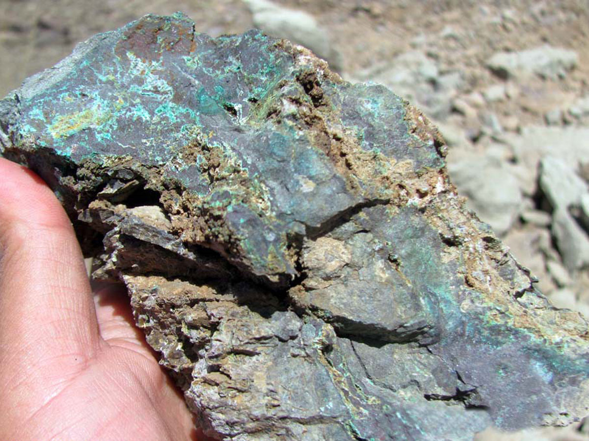
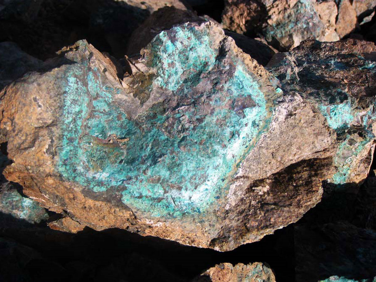
- Paragenesis of ore: Malachite, Chalcocite, Covellite, Azurite and Chalcopyrite
- Gangue type: Silica and Carbonate minerals
- Geochemical paragenesis: Silver, Copper and Barite
Geology
- Host rock: Andesite (Mega-Andesite), Basaltic Andesite Tuff (volcanic) in the vicinity of thick Lime (Orbitoline bearing)
- Age of host rock: Eocene-Oligocene (Eocene volcanics)
- Alteration: Propylitic, Chlorite, Epidote
Grade
Dimension of the mineral in this district is 600 meters length and 1 to 4 meters width and average copper grade in the oxide zone is 2 percent and in the sulfide zone is approximately 1 percent.
Proven Reserve
Proven reserve of Copper with the average grade of 1.4% is 205,958 tones and with the average grade of 2.3% is 100,987 tones.
Facilities
Water and electricity are located in 1.5 km of the area and there is dirt road to the mineralization zone.
Exploration Operations
- Collecting of available information, including geological and topographic maps, previous provided reports,… , doing office works and planning for performing field operations
- Preparing topographic map with the scale of 1:20,000 in 18.4 km2 area
- Preparing geological map with the scale of 1:20,000 in 18.4 km2 areas
- Taking 20 samples for preparing geological map with the scale of 1:20,000
- Studying thin and polished section of 20 samples for preparing geological map with the scale of 1:20,000
- Taking samples and chemical analysis by ICP method and Gold for 8 samples
- Studying, geological operation and prospecting in all of exploration area
- Digging 21 trenches by chipping in mineralized zones
- Drilling five exploration holes in the volume of 10 m3
- Survey of trenches sections and exploration holes (from the view of rock units, mineralization, topography and …) and computer drawing
- Taking samples from trenches and exploration holes of 26 samples and analysis them by ICP method
- Preparing topographic map with the scale of 1:1,000 in the 60 ha area of copper and barite mineralized zones
- Preparing geological map with the scale of 1:1,000 in the 60 ha area of copper and barite mineralized zones
- Geophysical operation in mineralized zones by IP and RS methods with five profiles which 784 points have been totally surveyed
- Taking five samples for preparing polished sections related to minerals recognition
- Preparing four samples from extraction of trench and hole digging and analysis by ICP method
- Drilling eight exploration boreholes in 421.75 m
- Cores cutting in 421.75 m and sampling from them
- Analysis of 63 taken samples from cores
- Logging of all boreholes and exploration data analysis and drawing the charts
- Reserve modeling
- Evaluation and estimation of Copper and Barite reserves
- Preparing the final reports
Ownership
This area has the exploitation license and belongs to Seyed Ali Meshkani.


پروژه های زرمش

Silijerd Exploration Area
Silijerd exploration area with exploration license with an area of 23.3 square kilometers is located in Markazi province, 17 kilometers northwest of Saveh city in Iran. This area is part of the Urmia- Dokhtar

Khalkhab Exploration Area
Khalkhab exploration area with exploitation license is located in Markazi province, north of Saveh city and northeast of Chenar village.This area with an area of 14.3 square kilometers is part of the Urmia-Dokh