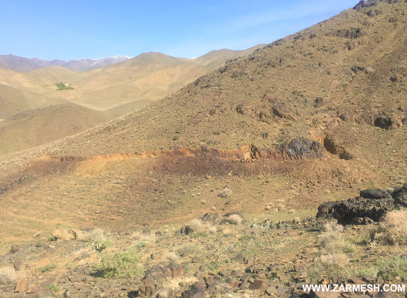
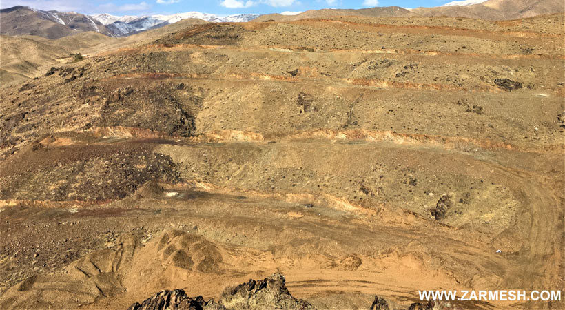
Niaz mineral area has an exploitation license in the central to western part of Iran and in terms of country divisions in Markazi province and 35 km northwest of Saveh And is located 2.5 km east of Nivesht village. This area is part of the Urmia-Dokhtar volcanic-intrusive belt.
Ore deposit type
Genesis: BIF, Skarn iron and copper vein
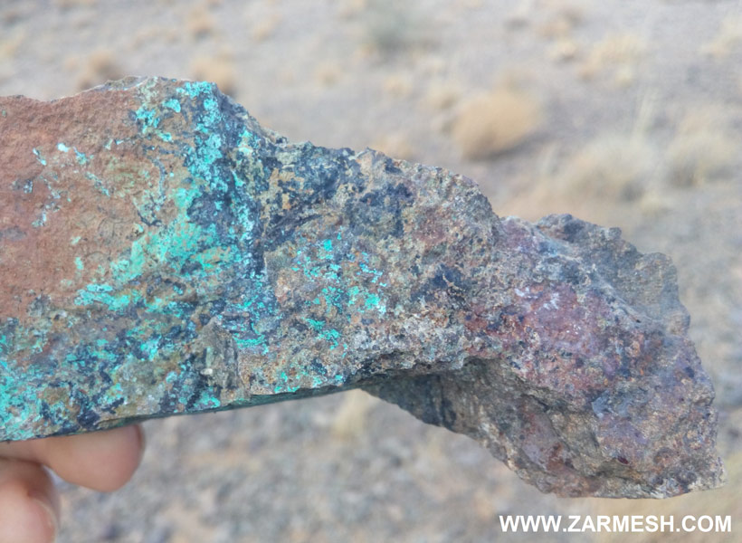
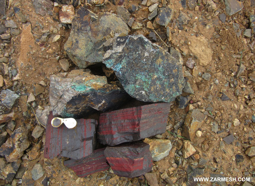
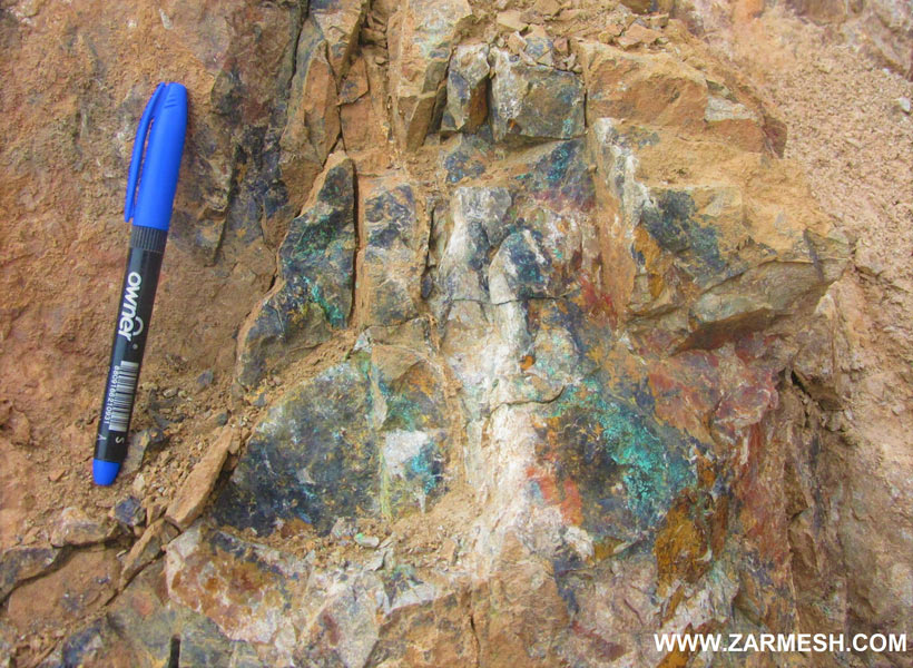
Paragenesis of minerals: Magnetite, hematite, malachite and chalcopyrite
Gangue type: Silica mineral
Geochemical paragenesis: Fe, (Cu, Au, Mo)
Geology
Structural Zone: Central Iran, Urmia-Dokhtar volcanic-intrusive belt
Host rocks type: Granodiorite, diorite, andesite, trachyandesite and tuff
Age of the host rock: Eocene to Miocene
Alteration: Argillic, Silica alteration, Propylitic and iron oxide
Dimensions of mineralization
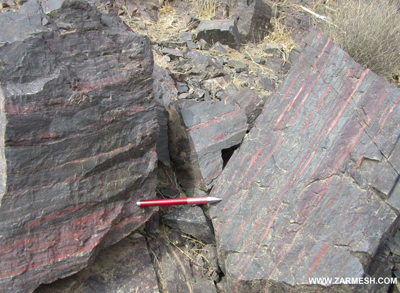
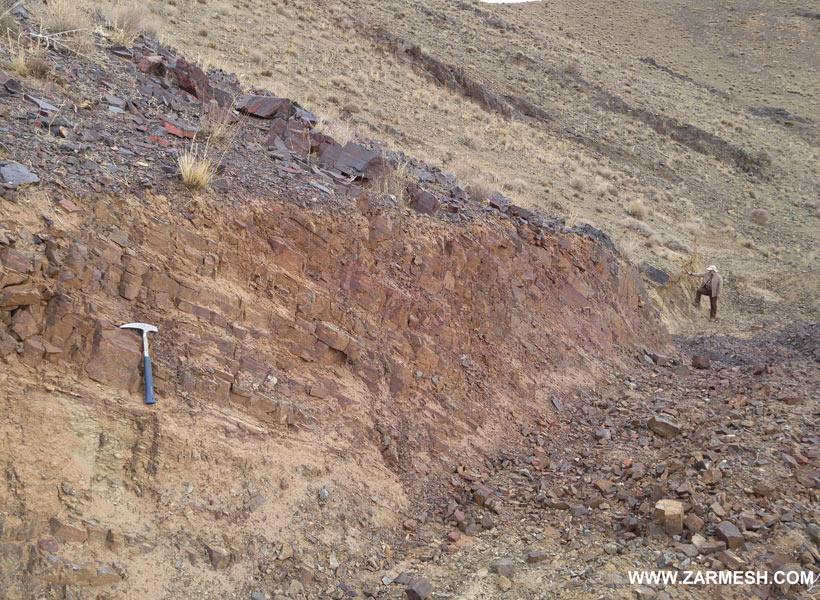
In the mineral area, the 3 types of mineralization with different genesis is important, including: Banded Iron Formation mineralization in the western part of the area, hosted by volcanic rocks with an average thickness of iron and jasper layers between 5 to 10 meters and a mineralization length of about 250 meters. Skarn iron in the eastern part of the area is hosted by granite intrusion (quartz monzodiorite) in the form of numerous magnetite-apatite veins with a thickness of 1 to 2 meters and a length of about 200 meters, and finally, copper mineralization in siliceous patches in the lower waist The intrusion mass of the east of the range is about 0.5 meters to 1 meter thick and about 20 meters long.
Proven reserve
The total reserve in Niaz iron, considering 20% as the economic limit grade, is equal to 600681 tons of iron ore with an average grade of 29/4%.
It should be noted that at present, this reserve estimate has been done only on the BIF zone and exploration operations in this area are still being carried out on the Iron skarn and Copper zone. This amount of reserves is expected to increase significantly.
Mineral grade
Fe total maximum 62/2% and average 36%, Cu maximum 2/2% and average 0/45%, Au maximum 4957 ppb and average 500 ppb, Ce maximum more than 1% and Mo maximum 1218 ppm and an average of 128 ppm.
Facilities
The area is located in 2.5 km of Nivesht village, which can provide the required manpower and electricity.
Also, Saveh-Hamedan freeway is located 7 km from Nivesht village.
Exploration operations
- Data collection including: geological and topographic maps and previously submitted reports
- Buy high resolution satellite images as aerial photographs of the study area
- Review, processing and integrate basic information layers, create a database and identify promising areas
- Interpretation of preliminary results, identification promising areas and their prioritization
- Field exploration and identification of mineralization zones
- Preparation of a geological map at a scale of 1: 25000 with an area of 9/96 square kilometers
- Preparation of a geological map at a scale of 1: 20000 in an area of 21/5 square kilometers
- Sampling and ICP-OES analysis of 34 rock samples in the prospect stage
- Sampling and Fire assay analysis of 31 rock samples in the prospect stage
- Sampling and XRF analysis of 15 rock samples in the prospect stage
- Preparation of 11 thin sections of rock units for petrology and mineralogy studies
- Performing geophysical profiles by magnetometry method in networks with dimensions of 5 × 10 meters and 1496 stations
- Preparation of mineral geology map in scale 1: 1000 with an area of 50/7 hectares
- Preparation of topographic map in scale 1: 1000 with an area of 50/7 hectares
- Construction of access roads with a length of more than 7 km
- Design and excavation of exploratory trenches using an excavator with 17 trenches with a length of 268 meters and a volume of 389 cubic meters
- Leng harvest trenches at 1: 200 and 1: 100 scale
- Sampling of excavated trenches in 35 samples
- Sending and analyzing 6 samples by ICP-OES and Fire Assay methods and 29 samples by XRF method
- Sending and analyzing 2 rock samples by XRD method for mineralogical studies
- Drilling 46 exploratory boreholes with a total length of 1038 meters
- Sampling and XRF analysis of 93 borehole powder samples
- Sending and analyzing 200 kg of rock samples for identification and behavioral studies of iron ore processing
- Evaluation and determination of storage volume, shape and tonnage of mineralization area based on excavated trenches and drilling using Datamine software
- Compilation of exploration operations report during extraction