Khansorkh polymetallic area with an area of 9/47 square kilometers, with an exploitation license, is located in Kerman province, 70 km northeast of Sirjan city. This area is located in the Urmia-Dokhtar volcanic-intrusive belt and the Dahaj-Sarduiyeh metallogenic area.
Ore deposit type
Genesis: IOCG-Types, Skarn
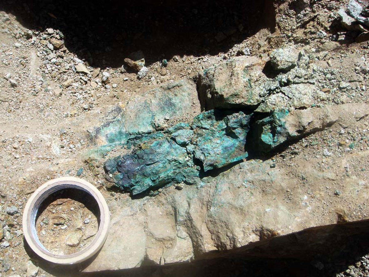
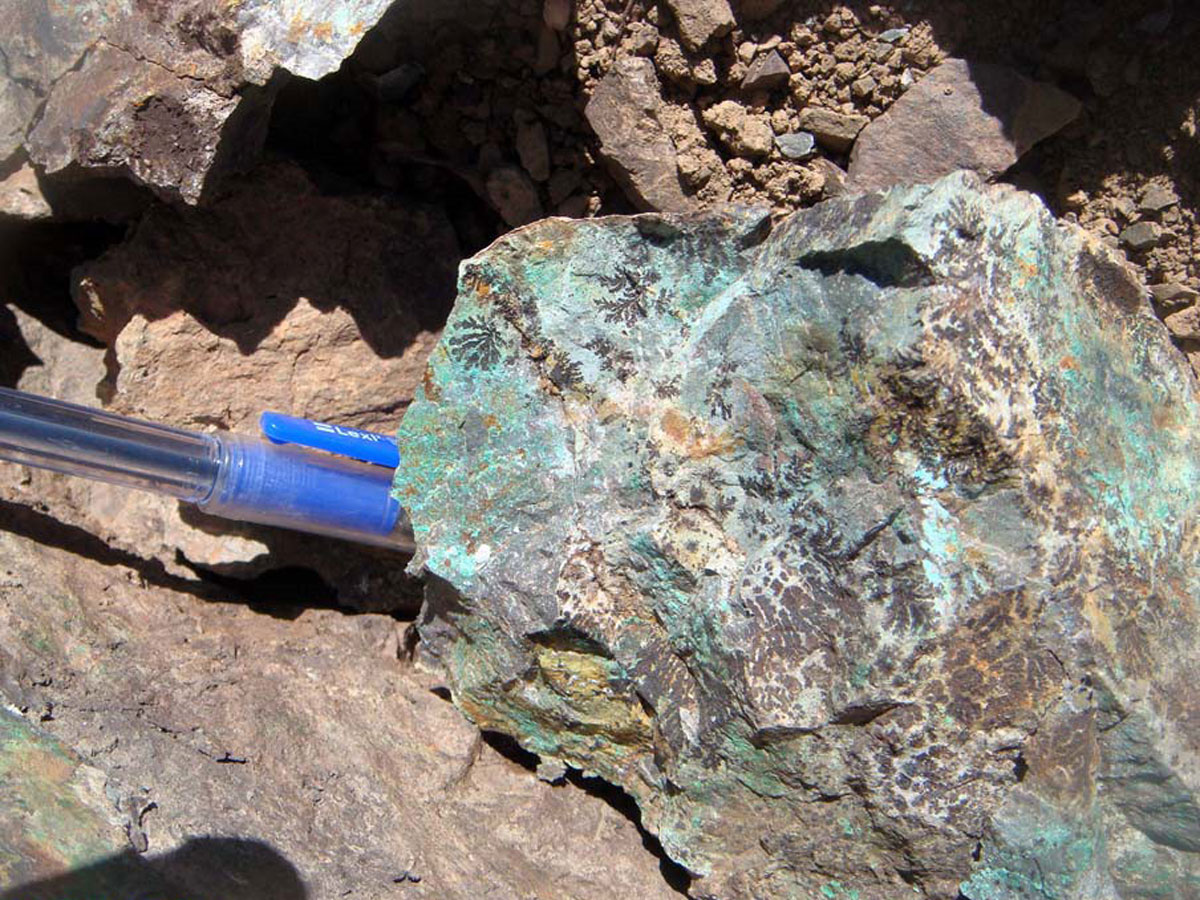
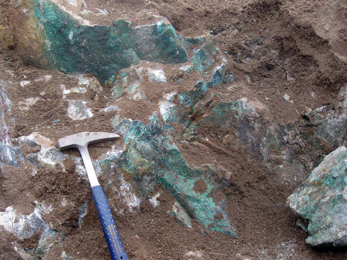
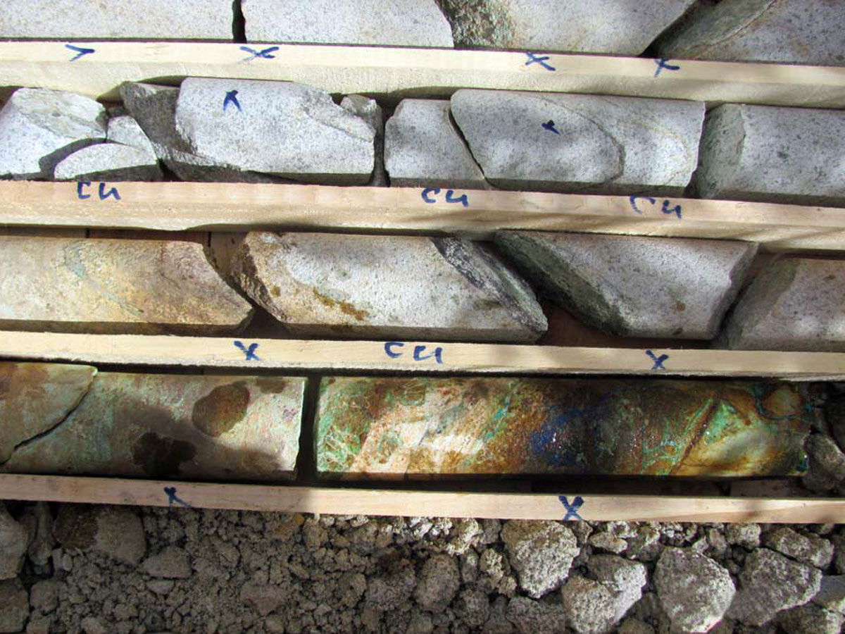
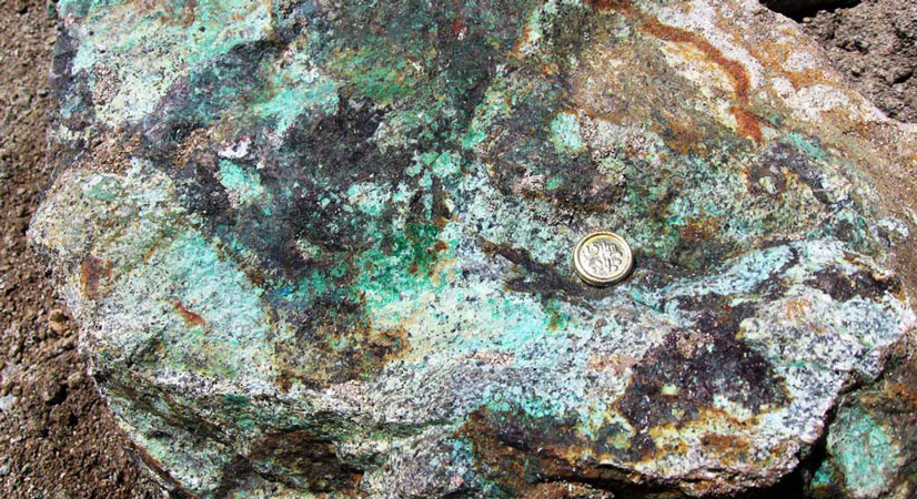
Paragenesis of minerals: Malachite, azurite, chalcopyrite, chalcocite, natural copper, magnetite, oligist and pyrite
Gangue type: Silica mineral
Geochemical paragenesis: (Cu, Au, REE, Mo, Fe), Zn
Geology
Structural Zone: Central Iran, Urmia-Dokhtar volcanic-intrusive belt
Host rocks type: Granite to granodiorite, aplite, metamorphic basaltic andesite, and basaltic dykes
Age of the host rock: Eocene to miocene
Alteration: Argillic, Silica alteration, sericitic alteration, chloritization, hornfels metamorphic in contact metamorphism
Dimensions of mineralization
According to the results of field surveys and geological maps, this area can be divided into 4 promising zones with a total of 486 hectares:
Zone (A) with an average grade of 1% copper and gold with a maximum grade of 378 ppb.
Zone (B) with an average grade of 2.4%copper and gold is a maximum of 618 ppb, also LREE in the form of paragenesis
Zone (C) with an average grade of 1.6% copper, zinc maximum 0.2% and gold maximum 580 ppb.
Zone (D) with an average grade of 0.95% of copper and gold is a maximum of 120 ppb.
It should be noted that vanadium, molybdenum and cobalt elements are also enriched.
Proven reserve
According to the exploration, the amount of definite reserves is equal to 327940 tons of copper ore with an average grade of about 1.6%. (It should also be noted that the amount of reserves based on the exploration certificate issued is equal to 125,000 tons with an average grade of 0.5%).
Also, the probable reserve is about 506,500 tons of ore with an average grade of about 1.26%.
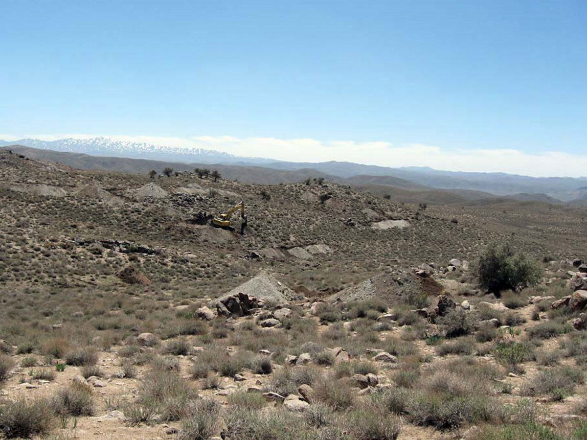
Currently, trenching operations are underway on mineralization zones in this area.
Due to the emergence of new mineralization zones within the trenches, this amount of reserve is likely to increase significantly.
It should be noted that the final reseve and grade of gold as well as rare earth elements in this area have not been determined yet, but since these elements have significant anomalies, it is predicted that the extraction and processing of these elements will be economically viable.
Mineral grade
Cu maximum 8.35% and average 1%, Au maximum 962 ppm, Fe maximum 26%
Mo maximum 459 ppm, LREE maximum 0.2% and Zn maximum 0.3%
Facilities
Asphalt road is 12 km away and dirt road is available to the mineral outcrop. There are also many summer villages around the area that can help provide manpower.
Exploration operations
- Collecting information; including geological and topographic maps, previous reports and…, doing office work and planning for field operations.
- Preparation of a geological map at a scale of 1: 20,000 with an area of 78 square kilometers
- Preparation of topographic map at a scale of 1: 20,000 with an area of 14/78 square kilometers
- Preparation of topographic and geological map at a scale of 1: 1000 with an area of 60 hectares
- Collection and analysis of 97 rock samples by ICP-OES method, 84 rock samples for Fire Assay analysis and 4 samples for XRF analysis in the prospecting stage
- Preparation of Aster satellite imagery for remote sensing studies and determination of various alterations
- Exploration trench excavation with a volume of about 3219 cubic meters, road construction and trench excavation operations continue
- Drilling exploratory wells with a volume of about 30 cubic meters
- Collection and analysis of 136 rock samples from trench and walls and analysis of this number of samples by ICP-OES and Fire Assay method and 20 thin section and polished section samples for petrographic and mineralogical studies
- Length drawing of trenches with a scale of 1: 200
- Performing IP&RS geophysical operations to determine the amount of induced polarization and to determine the specific resistance on the profiles perpendicular to the mineralization zone in the northern and southern parts of the mineralization at 960 points.
- Design and drilling of boreholes with 375.6 meters long
- Core logging with 375.6 meters long
- Modeling and evaluation of reserves based on depth and surface data
- Prepare a report on the end of exploration operations