
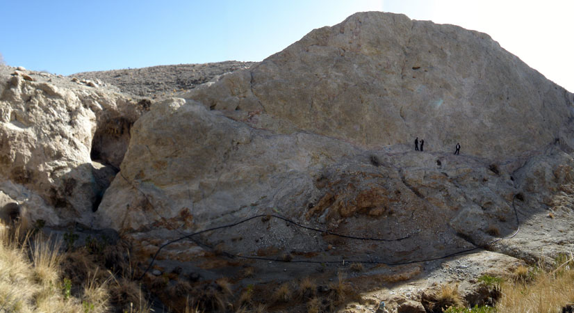
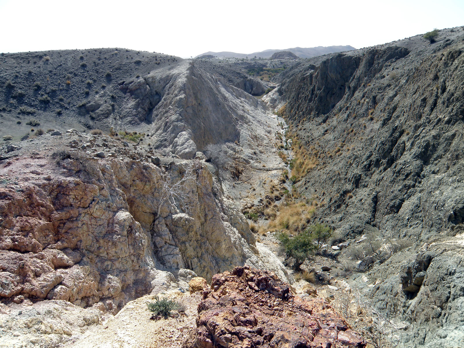
Copper and Molybdenum district of Darb Mazar with the area of 38 km, is located in Kerman province, near the city of Jiroft. This district is located in the Urmia-Dokhtar (Jabal Barez) exploration zone. The target area is 25 km far from Jiroft Road to Kerman (Delfard Road), the village of Darb Mazar, next to the main road of Jiroft-Kerman.
Darb Mazar Cu with Mo
Projects
Reserve Type
- Genesis: Porphyry and in some parts of the district is vein.
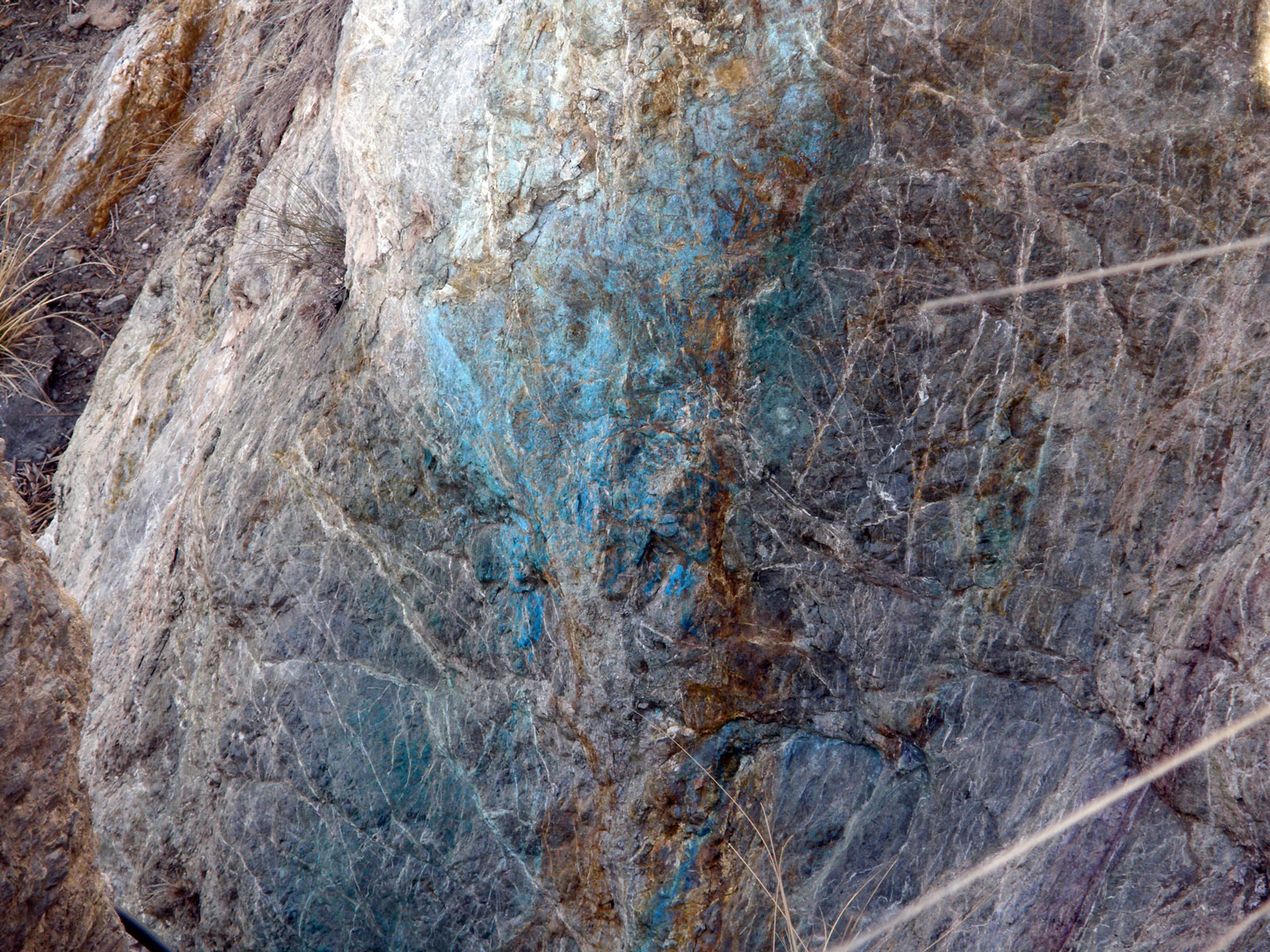
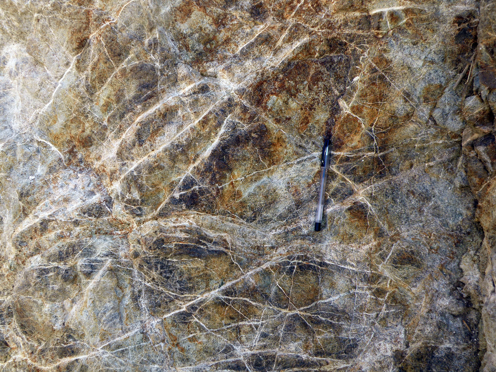
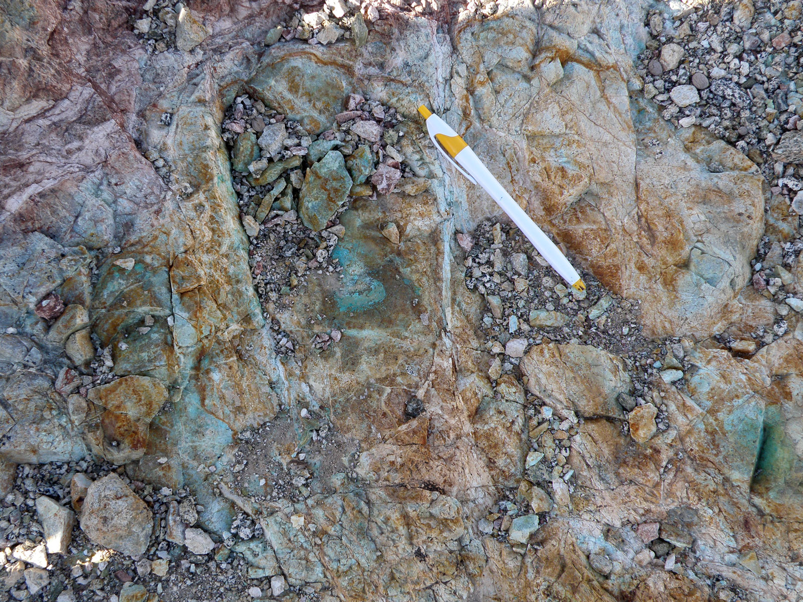
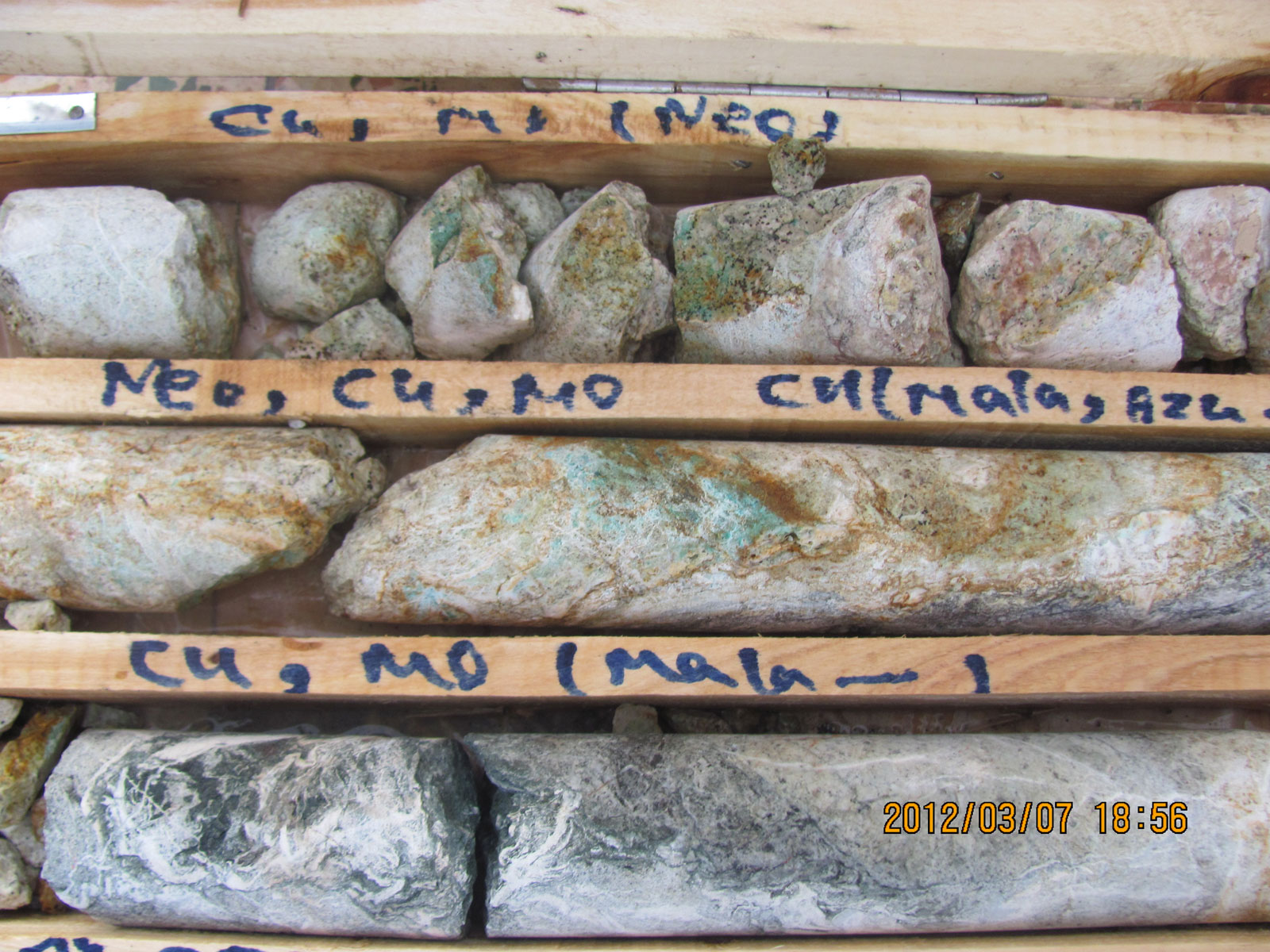
- Paragenesis: Malachite, Azurite, Chalcopyrite, Chalcocite, Molybdenite, Ferro Molybdenum, Iron hydroxides, Silica
- Type of ore and minerals: Chalcopyrite, Molybdenite, Malachite, Azurite, Pyrite, Hematite and Goethite.
- Gangue type: Silica and calcite veinlets
- Geochemical paragenesis: Copper, Molybdenum and Gold
Geology
- Host rock: Granodiorite to Quartz diorite and Leucogranite
- Age of host rock: Eocene and Paleocene
- Alteration: Argillic, Propylitic and Phyllic
Reserve Amount
Dimensions of ore in porphyry section according to mineral outcrop, is a mass of 750 to 1000 m in length, width of 50 to 150 m and a height of about 40 m, and the average grade of copper in this section is between 0/3 to 1% and molybdenum grade is between 15 to 70 ppm. In the vein section, there are several veins with the length of between 10 to 100 m and width of 1 to 2 m and the copper grade is between 2% to 5%, and the grade of gold is between 200 to 1000 ppb and the grade of molybdenum is between 50 to 115 ppm.
Proven Reserve
According to exploratory operations in this region, the minimum proven reserve is about 648,000 tons of Copper ore with the average grade of 0.51 percent and about 800,000 tons of Molybdenum ore with the grade of 80 grams per ton.
Facilities
Water, electricity and asphalted roads are about 500 meters far from the mineral deposit and the rest of the road is 200 meters dirt road.
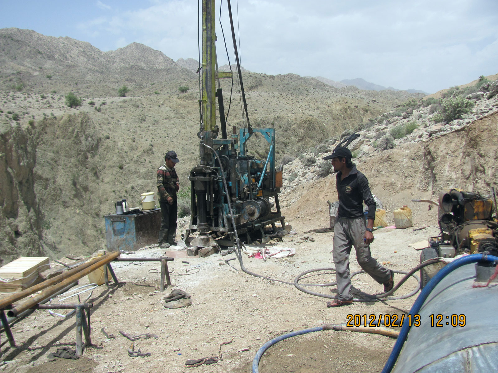
Exploration Operations
- This target district has two types of mineralization, first: porphyry type and second: veins and veinlet-disseminated mineralization
- Gathering information including maps, regional geology, index and local mine information
- Purchasing and processing aster landsat satellite data
- Sampling from the mineralization
- Providing Geological map (Scale: 1:20000)
- Providing the Geological and Topographic map (Scale: 1:1000)
- Systematic sampling (10*10 GRID) for 120 samples from the mineral outcrop and sending them for analysis
- Geophysical exploration by RS & IP methods (1,050 Points)
- Trench drilling (total length 250m)
- Drilling 645 meters (four, 150m well)
- Logging and core cutting for 600m
- Sampling from the core (300 samples) and send them to the laboratory for analysis
- Providing a preliminary and semi-detailed exploration map and presenting them to mining and industry organization
Ownership
This district has the exploitation license and belongs to Zamin Jouyan Pars Company.


پروژه های زرمش

Silijerd Exploration Area
Silijerd exploration area with exploration license with an area of 23.3 square kilometers is located in Markazi province, 17 kilometers northwest of Saveh city in Iran. This area is part of the Urmia- Dokhtar

Khalkhab Exploration Area
Khalkhab exploration area with exploitation license is located in Markazi province, north of Saveh city and northeast of Chenar village.This area with an area of 14.3 square kilometers is part of the Urmia-Dokh